Back Roads Tours – 12 Days – The Emerald Isle – Ireland continued…….
“………I literally stumble across a farmer’s market in the centre of the village and the photo opportunities about me are endless. I see farmers with time-worn, leathery weather beaten faces dressed in freshly laundered woollen jumpers, flannellette shirts, dark pants or jeans and veststyle or longsleeved wind breaker jackets. Most are wearing a beanie and solid leather boots. They are ready for a day’s business in sheep trading. And socialising. Or is that socialising and business in sheep trading? The farmers stand or sit in small groups near the stock which are milling about restlessly in small trailers or makeshift sheep pens hastiliy erected in cordoned off car parks on both sides of the road, and they chat to each other as well as random passersby strolling the pavements…….”
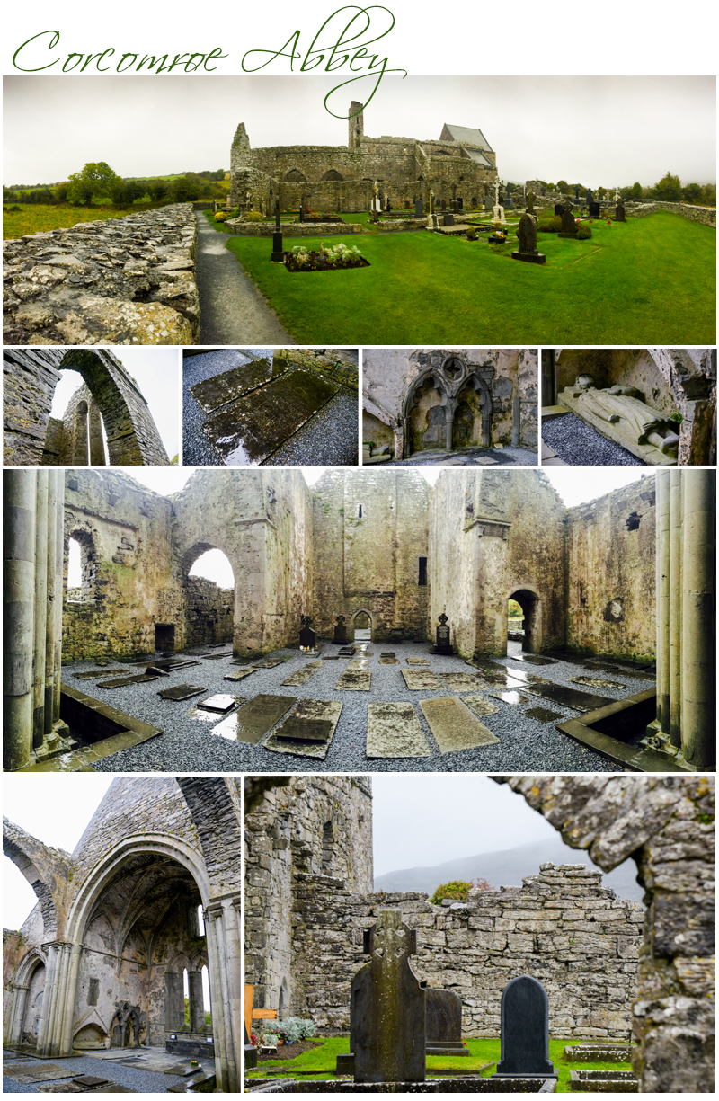
Day Thirty Two – 16th. October – Sunday – Galway disappears behind us as we drive along a coast road edging of the Atlantic Ocean. We are heading south. We make a short stop at Corcomroe Abbey an early 13th-century Cistercian monastery located in the north of the Burren region of County Clare, only a few miles east of the village of Ballyvaughan. Whilst the roof is missing much of the wall and arch structure is in reasonable condition, so there’s some lovely photos to be had even though it’s raining. The Abbey is simply too beautiful not to be out in the weather and simply without enough hands to navigate successfully both a camera and an umbrella I am soon saturated as my biggest concern is keeping my camera dry, which I manage but to my own personal cost. I wander amongst the lichen and moss brushed gravestones in the church grounds. I then head into the captivating roofless Abbey where more historic gravestones form part of the Abbey ‘s floor. Corcomroe Abbey is a stunning beautiful structure and I feel incredibly peaceful and blessed to be visiting on this rainy cloudkissed day.
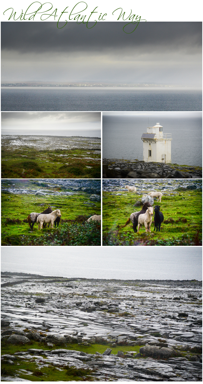
We are travelling on the Wild Atlantic Way, a secondary twisting, meandering road which follows the coast to Doolin and the nearby Cliffs of Moher and the drive is particularly scenic as we pass Ballyvaughan and its nearby coastline. Flattish patterns of eroded stone and grassy earth stretch between the coach and the water’s edge in a cobblestone effect. We stop for a photo even though it’s raining and looking back across the water I can see Galway fading off into the distance. The sky above is pregnantly heavy with dark clouds now and as we depart rain falls in earnest. Striking hand made stone walls and fences are everywhere some sectioning off areas for farming whilst others, built during the potato famine to keep the population busy at a time of no work, serve no real purpose at all.
The Cliffs of Moher are located at the southwestern edge of the Burren region also in County Clare. They rise 120 metres above the Atlantic Ocean at Hag’s Head and reach their maximum height of 214 metres just north of O’Brien’s Tower eight kilometres to the north. A round stone tower near the midpoint of the cliffs was built in 1835 by Sir Cornelius O’Brien. On a clear day from the cliffs and from atop the tower, visitors can see the Aran Islands in Galway Bay, the Maumturks and Twelve Pins Mountain Ranges to the north in County Galway, as well as Loop Head to the south. The Cliffs of Moher rank amongst the most visited tourist sites in Ireland and receive approximately one million visitors a year.
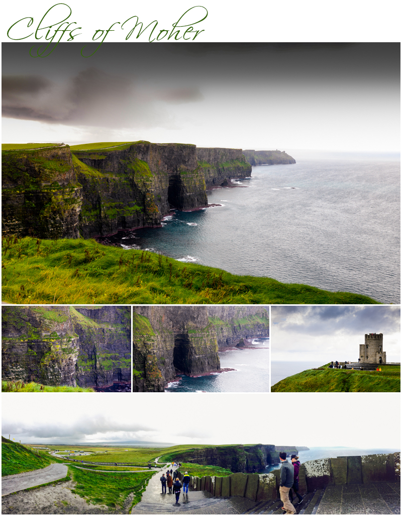
The cliffs are a stunning addition to the landscape. Rising up from the edge of the ocean they form a particularly dramatic silhouette from a distance. And closer, after I’ve walked up the hill past the visitor centre entrance to the cliffs’ edge, they are richly textured with shape and form. Emerald green grasses contrast richly with the earthy chocolate browns and deep currant reds of the rock which layer to form the majestic rises in landforms. And the sky, lead grey today, diffuses all light and shadow evenly.
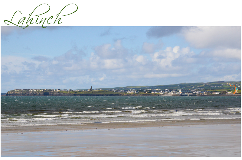
We stop for lunch at Lahinch, passing a major golf course built in the late 1800’s as we enter the village near a long beach. Today there are two people windsurfing, and as I watch the sand below my perch at O’Looney’s Restaurant where I’m eating my lunch, four teenagers walk out to the surf and bravely take a dip in the sea in bikinis and swimmers. It’s all of 13 degrees outside today so they don’t dally there for long, and as they emerge from the surf someone meets them with dry towels which they instantly wrap around themselves to reduce the chill on their bodies from the blustery winds blowing in across the sea.
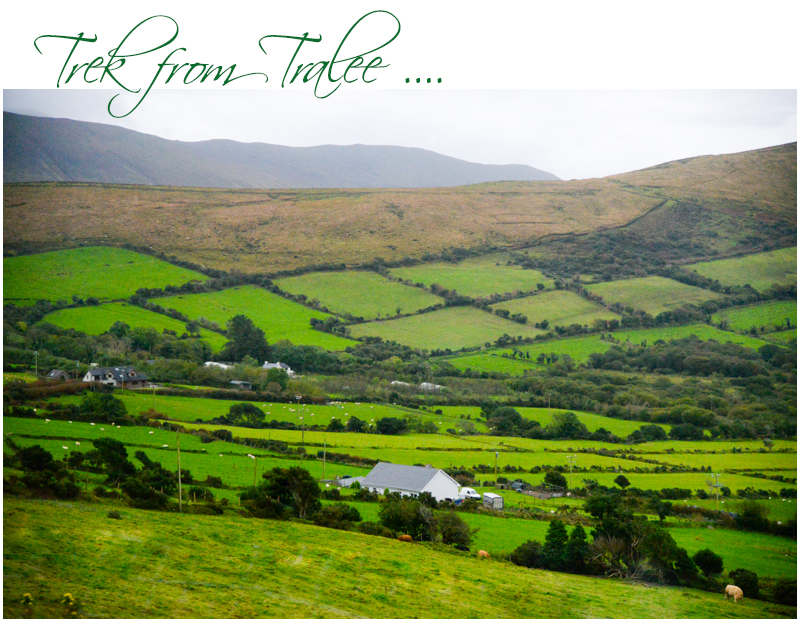
The Shannon Ferry is ahead and we take the twenty minute crossing to save back tracking inland later in the afternoon around the Shannon Estuary. Continuing on, we then trek further along the Wild Atlantic Way and pass through Tralee as we head toward the Dingle Peninsula, then Dingle for our next overnight. The road rises quickly in elevation after Tralee and the hilltops to the left and ahead are covered in thick low cloud as we skim the ridge of a bowl shaped valley on the right. From the top edge of the valley we can see for miles down across the green patchwork quilt farms and fields to the sea beyond. To the left, paddocks dwindle to nothing and suddenly turn into sweeping rises that peak into dramatic mountain vistas. Irish sheep and cows are here and there, on both sides of the road, and tiny farmhouses dot the slopes and rises all vying for the best position on their plot of land to make the most of the outstanding views. The stone fences so predominant earlier today give way to hedges and fences, and farm buildings start to appear around the houses. It is spectacular.
Day Thirty Three – 17th. October – Monday – It is raining again when I awake this morning but by departure time 9:30 am, the lovely clear sunny day we ordered is trying to make an appearance. And by our first stop, the Prehistoric Beehive Houses near Dingle, there is blue sky and sunshine. We pull up by the side of the road in a parking bay and walk across to a tiny portable hut. There’s a man inside collecting €3 per person as the huts are on his land and not government owned title. He’s crouched over a column oil heater as it’s chilly outside at 9:50 am and a cool 11 degrees. He takes €45 from our coach load of visitors and an additional €18 from others that arrive whilst we are there. He’s making money today even though it is no longer prime tourist season.
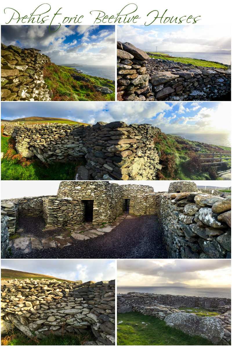
Fahan is the area on the Dingle Peninsula where we are visiting. It’s in County Kerry, which is known for its collection of clochan, or circular drystone beehive huts. Fahan lies below Mount Eagle on the southern coast of the Dingle peninsula, to the west is the fishing village of Ventry and to the east of the steep cliffs of Slea Head. The drystone huts are well built and have been standing for hundreds if not thousands of years. This is disputed, as some accounts believe the huts have been there a lot longer than other sources. The huts are shaped like beehives and are an acclaimed engineering feat. The roofs slope inwards as they rise overhead. The ones here have sections of the roofs missing but they are a testimony to the ingenuity and resourcefulness of the people that lived in the region in the earliest of times, as they still form solid protection against the environment’s harshest elements. They all have hearths in a section of the bottom of the walls.
Long walls surround the huts in an outside enclosure which have caches in them, maybe for storage of food, fodder or fuel for fires. And the huts together form a tight cluster within the enclosure. It is situated on the rise of a hill and the views from the area where the huts are located are comprehensive. You can see the sea and other settlements on the Peninsula, as well as the Blasket Islands, a group of small islands once inhabited by only the most resilient of Irish people, up until only recent times.
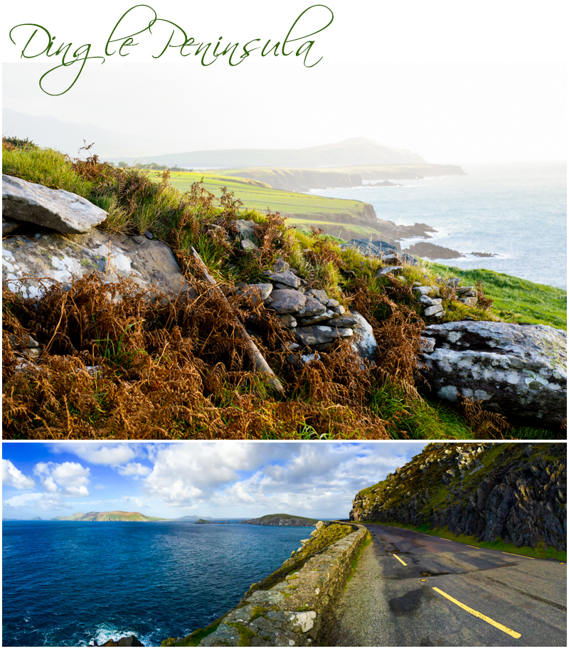
We drive on after a twenty minute stop and in every direction the rich drama of the Irish land and sea scape unfolds. A roadway is cut into the side of steep hills, a stone wall sits atop a dramatic drop off, there’s a rocky coastline and islands in the distance off shore to the left. Stone stacked fences strongly delineating fields, farmland, and houses, as well as animals and other structures, are on the right. It’s a wonderfully scenic drive.
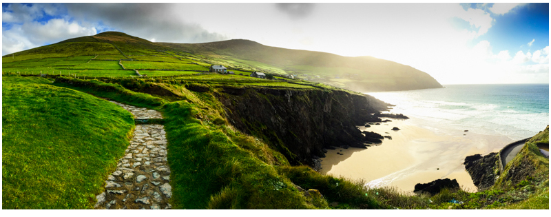
The Blasket Islands Visitor Centre is our destination this morning and upon arrival we are ushered into a theatre to watch a short film on the Blasket Islands history and the native inhabitants. The islands we are told, were inhabited until 1953, when the Irish government decided that it could no longer guarantee the safety of the remaining population. We see that the inhabitants had a hard life, living in an area with severe climate factors. The summers brought work, farming and fishing as well as community and social interaction, education and development, but the winters, harsh to the extreme, found residents locked in their homes for long periods, without work or meaningful interaction within the community to escape the harsh weather conditions, and isolated from the mainland due to severe winds and violent sea storms.
The Blasket Islands was once the home of three noted Irish writers, Tomás Ó Criomhthain, Peig Sayers and Muiris Ó Súilleabháin although at least another nine writers are also noted as being relative to the island group’s network of scholars. Their works, considered to be outstanding in the literary world, were all written in Irish, but have since all been translated into English as well as other languages. Apparently the homes of Tomás Ó Criomhthain and Muiris Ó Súilleabháin are now in ruins, but the house in which Sayers once lived was restored and formed part of a hostel which previously functioned on the island. Until 1953, the inhabitants of Great Blasket Island formed the most westerly settlement in Ireland, and indeed Europe. The small fishing community (at its peak the population was barely more than 150) and most inhabitants lived in basic cottages perched on the relatively sheltered north-east shore. Interestingly the island had a king and all the residents spoke Irish.
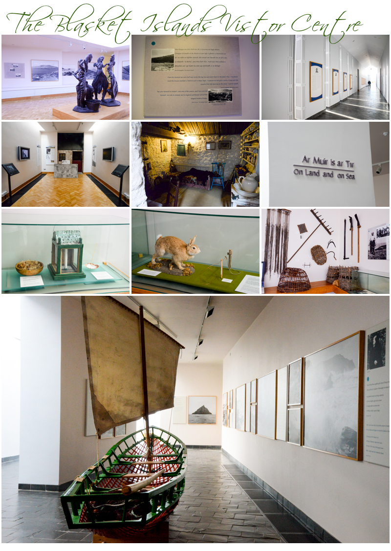
The centre has some interesting displays and a brief synopsis’ on each of the main figures in the island’s history and it is a fascinating glimpse into a unique lifestyle, and culture. There are no trees on the islands, but the residents use wooden boats to fish. And the islands are so tiny that the residents named every nook and cranny, every cove and beach, every field and house. It was an insular lifestyle there, and a lifestyle without hope of any real long term prosperity. So the dwindling numbers attending school there, and lack of services, eventually forced the government decision to relocate the last residents on the island to the mainland.
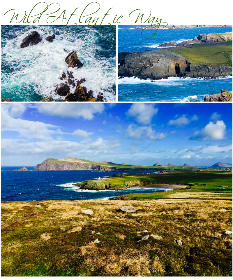
We leave the visitor centre and continue driving on the Wild Atlantic Way road on towards the land formation loosely referred to as the Sydney Opera House, the site of the latest filming for the next film in the Star Wars Saga, due for release in November. We stop for photos and then move on, taking the road which loops around the coast and brings us back to Dingle.
The rest of the day is free time, so I hop off the bus on the way back to the hotel and find some lunch in a shop nearby the town centre. I then trek my way through the town on foot looking at the stores, a church and eventually manage to find and visit the Dingle Crystal shop. From there I head back to the hotel and write some post cards before going to the Post Office to post them. I rest briefly this afternoon, then have a meal at the hotel where we are staying with some of the ladies on the tour tonight.
Day Thirty Four -18th. October – Tuesday – Leaving Dingle behind we head to MacGillycuddy’s Reeks then onto Killarney Lakes but first we see beaches and the mainland across the way from the peninsula which skirts the sea. The weather is starting to clear in the distance on the left of the road so the waves, muted oyster grey with the soft morning light to the right, blends with the sky and the landforms beyond in a smooth transition of hues. There’s some forest and woodlands areas on the drive this morning as we leave the beach area, there are towering old and mature trees and the forest floor is thick with leaf litter and plant decay. The road then twists its way through to the Killarney Lakes region and we are teased with glimpses of these stunning water bodies from amongst the trees as the coach winds its way through the area known as County Kerry.
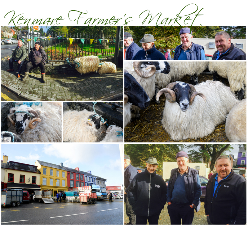
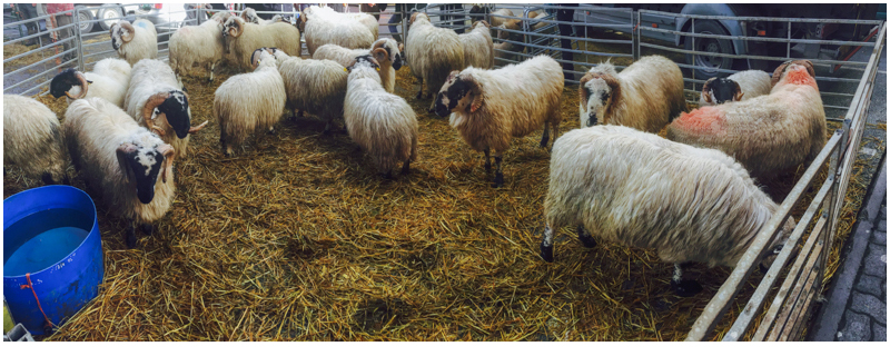
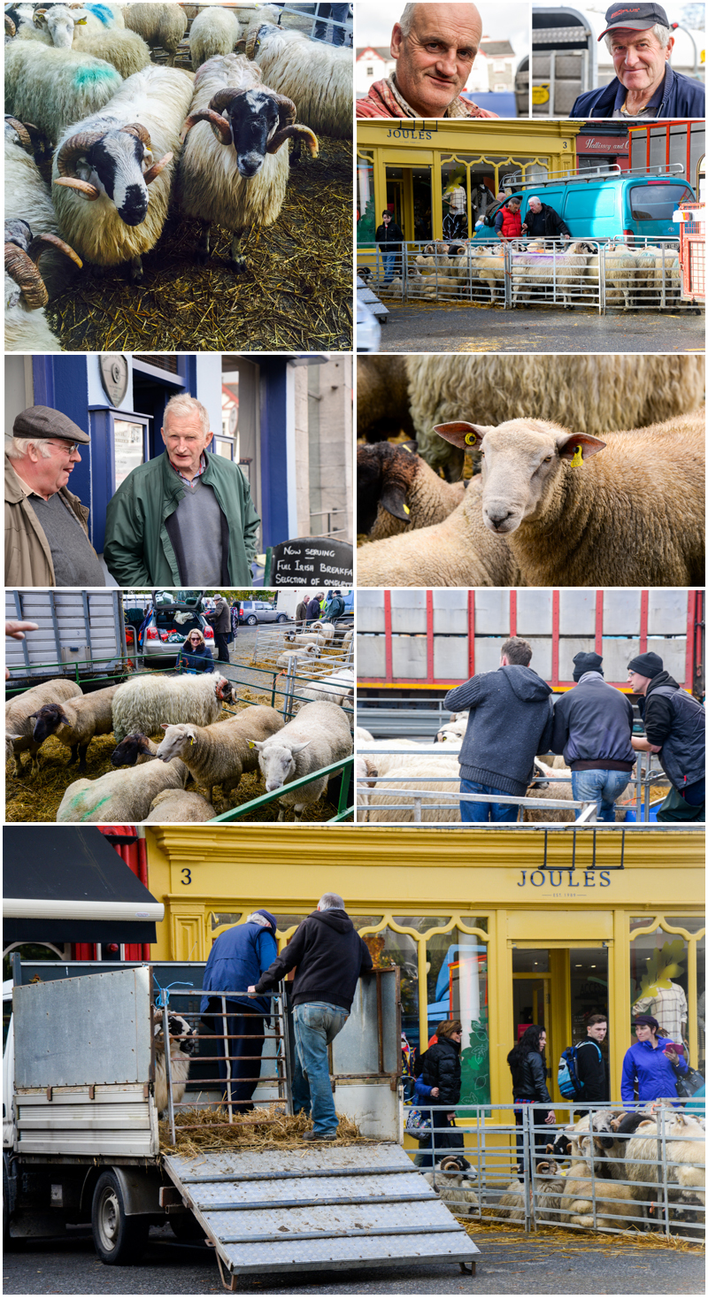
We pause the tour briefly in Kenmare for a stroll and coffee but I literally stumble across a farmer’s sheep market in the centre of the village and the photo opportunities about me are endless. I see farmers with time-worn, leathery weather beaten faces dressed in freshly laundered woollen jumpers, flannelette shirts, dark pants or jeans and vest style or long sleeved wind-breaker jackets. Most are wearing a beanie and solid leather boots. They are ready for a day’s business in sheep trading. And socialising…….or is that socialising and business in sheep trading? The farmers stand or sit in small groups near the stock which mill about restlessly in small trailers or makeshift sheep pens hastily erected in cordoned off car parks straddling both sides of the road. The farmers chat to each other as well as random passersby strolling the pavements.
There’s a mix of breeds here today as well as ewes and rams, sometimes all in the same pen. The gentle animals are woolly and large with full fleeces. There are no freshly shorn sheep. In one pen I see two rams butting heads, both have soft sooty black faces, large luminous eyes, and dark, long spiralling horns. Their heads are set atop dense fleeces of parchment and cream coloured wool that looked roughly combed, almost matted and bordering on forming dreadlocks.
Across the street tied to a fence by a short length of blue rope, and under a banner of small colourful yellow and green flags, there’s two more sheep. The owners sit comfortably next to them on a low stone wall. And suddenly the day becomes personal for me. I am experiencing more than a visit to a different country, a new landscape and a tour to experience and see a new culture. I am amidst farmers who form the true heart of Ireland’s countryside.
I stop and chat several times to several farmers as I walk along……Yes that ram’s for sale……it’s €200 and its breed is Scottish……that one there is French. And what breed of sheep are those I ask?…….The farmer replies and points……Cheviot and Suffolk. It’s not long before I am asked……and where are you from?……Me, I reply? …….Two hours out of Melbourne in Victoria, Australia. My father was a sheep farmer as was I. My father built his own shearing shed and his father before him had a depot shed in the Victorian Mallee in the 1920’s, so all of the neighbours bought their sheep to his shed for shearing…..I used to rouse about in my father’s then my own family’s sheds, skirting wool and sweeping the shed floor……I also did a lot of lamb marking and regular shifting of sheep from paddock to paddock…….We grew Merino Poll Dorset Cross some twenty plus years ago, but eventually left the sheep and wool industries in favour of cereal farming…….. And my time at the the stop in Kenmare passes by far too quickly.
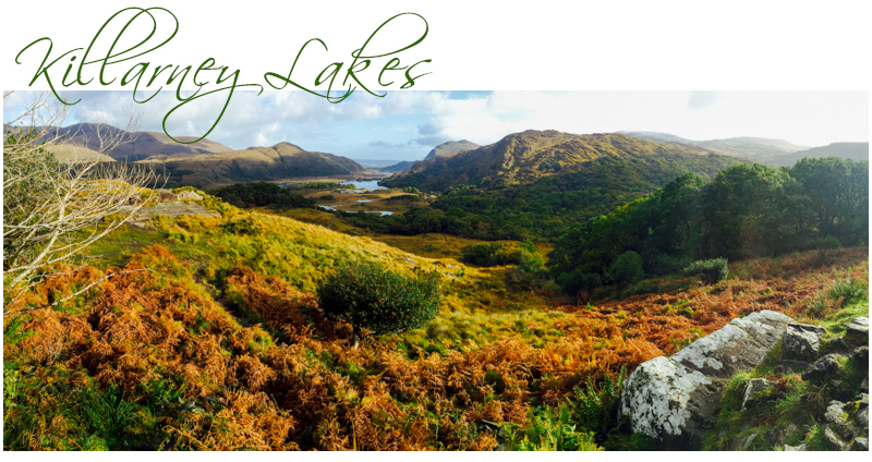
We leave the market place by twelve fifteen and head into higher country, stopping for photos several times. At one point we back up ridiculously close to the edge of a sheer drop off as there’s a car stopped in the middle of the whole parking bay leaving no room for others to park. They are so in awe of the view that they, too, just had to stop for a photo. The sweep of the landscape below is inspiring. Alabaster and eggshell coloured rocky outcrops are set in chartreuse brushed grassy rises in the foreground. The higher slopes slowly fall away to shamrock green fields marked by stone fences and hedging, and below is a lake, steel grey and serene today, as it reflects a moody sky. Beyond the lake, in the distance, deeply hued spruce and juniper coloured mountains rise dramatically. I turn around and face the landscape on the other side of the road and it too is compelling. I see gigantic hills rising before me, their faces sliced at regular intervals with alternating jutting ribbons of the stone and velvety grass. And scattered about, are a handful of long fleeced woolly sheep grazing peacefully on their tiny perches. Paradise.
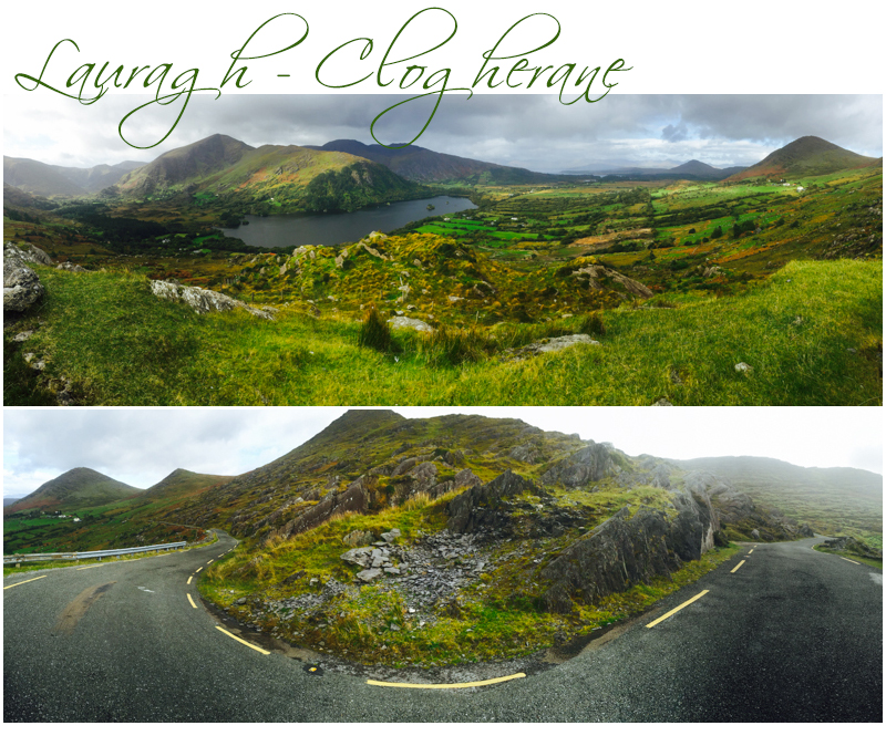
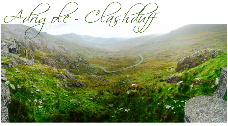
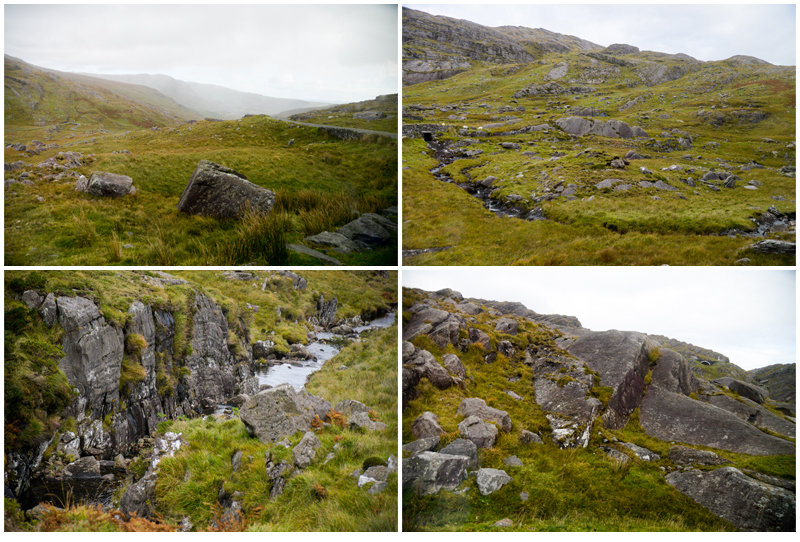
We head over the Healey Pass shortly after, the pass marking the border between two counties, County Kerry and County Cork. And we are, for a time, very high in elevation. There are natural waterfalls on the lee-side of the hills every kilometre or so, and the roadway twists its way wildly up down just as dramatically through a series of precarious hairpin bends until we reach lower elevations. We are literally hanging onto our seats as we manoeuvre our way around the bends as the coach swings first one direction then the other.
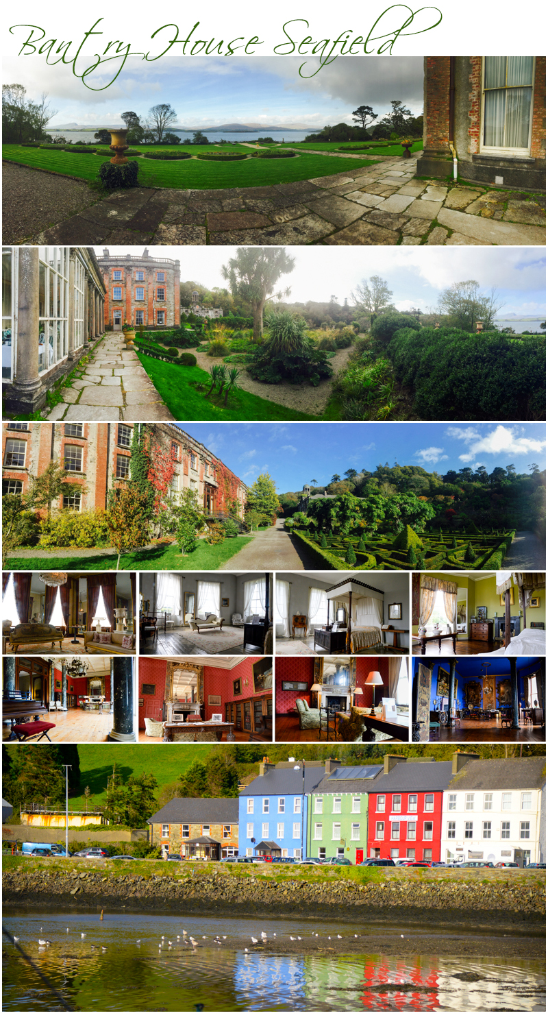
We head into Bantry which is in County Cork shortly after and drive through town along the sea side. The tide is out at the moment and a boat sits perched high above the ground waiting for the tide to come back in. Just beyond the town’s edge is Bantry House, originally called Blackrock, and built in about 1700 AD. We are stopping here for lunch and we have an opportunity to wander the house and stunning gardens. In 1750 Blackrock’s name was changed to Seafield and considerable land purchases around the house in the 1780’s were made and added to the house, some 80,000 acres, not all of which was arable land. The house, now called Bantry House, is not in a pristine state today, but is still very regal and has been open to the public since about 1946.
The gardens are perhaps one of Bantry House’s most outstanding features. There are seven terraces, and the house is located on the third. There is a walled garden too, but it is in disrepair. One hundred steps are located behind the house and are built as if to appear to rise out of a fountain. They are surrounded by azaleas and rhododendron. The gardens today are well maintained formal gardens with hedges and topiary but there’s still a lot of restoration work required to the actual building if this gentle monolith is to ever return to its former glory. It’s currently a working B & B and today we enjoy lunch in the House’s tea rooms. Both Sandra and I have Butternut Squash and Carrot Soup, and fresh made ham, egg and cheese sandwiches. Delicious.
A fair drive after lunch, inland away from the coast this time, took us onto Blarney, the home of Blarney Castle and the famous Blarney Stone. With not enough time to view the castle this evening, our two overnights here should give us some free time there first thing in the morning as tomorrow we depart for our days’ adventures at 10:00 am. I head across to the Blarney Woollen Mills before dinner however, which is only a short stroll from our accommodation, and as I step inside, the huge showrooms in the mill become a beautiful Christmas wonderland as even though it’s October, decorations and items for sale are sprinkled liberally throughout the period warehouse.
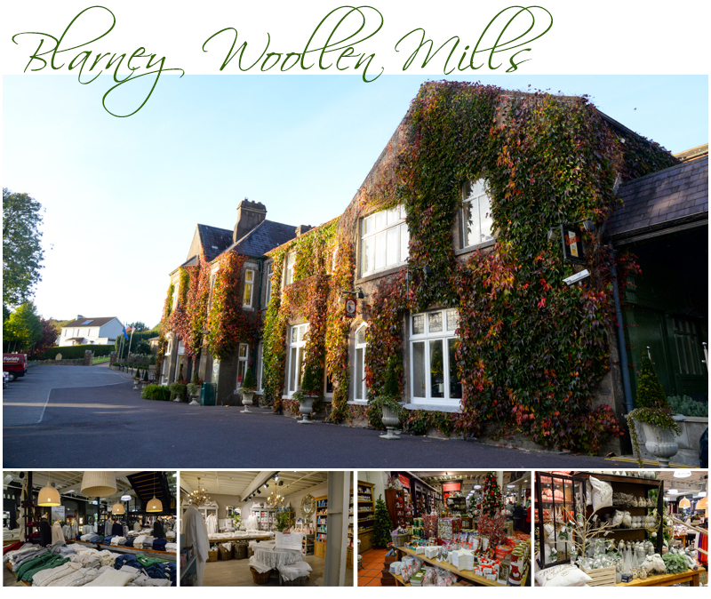
Last night turned out a surprise. After writing my blog I went down to the bar to find it cloaked in darkness, very few lights on. A large group of Irish musicians were clustered around in a circle, playing Irish jigs and folk songs. No one was singing, it was entirely instrumental. The time keeper seemed to be a man on a wind instrument of some sort with a pipe, but not bagpipes. I think it was a set of Uilleann Pipes. There were at least four fiddlers two men and two women, a lass on a small handheld wind box called a button accordion, two young lads about fourteen on Irish banjos, and an older man playing a wind flute shaped like a recorder. Several of the group could play different instruments. One lass played the fiddle for a time then picked up an Irish flute. The older man playing the pipe, broke into tune using the spoons during another song, and then later a fiddle.
I tried to photograph it but without using a flash it was simply too dark. And my phone camera was completely useless. The Nikon’s camera setting of ISO 6400 at 50/sec was also simply not good enough, so rather than miss out on getting some thing to keep from the evening, I decided to simply record the sound, so I may sync it as the background to a video to be made when I return home as I’m videoing around thirty seconds of film every day whilst I’m away.
The music was really good. Really, really good, mostly because it was “off the cuff”, spontaneous, and heartfelt. The group would play spontaneously about for about five or more minutes then relax and tune the instruments, or pick food off a platter the bar attendant had placed on a table in the middle of the group for the next five. There was very little chat. Then one of the group would strike up a tune solo, the others joining in one by one until they all had the gist of what to play and more importantly what to play together.
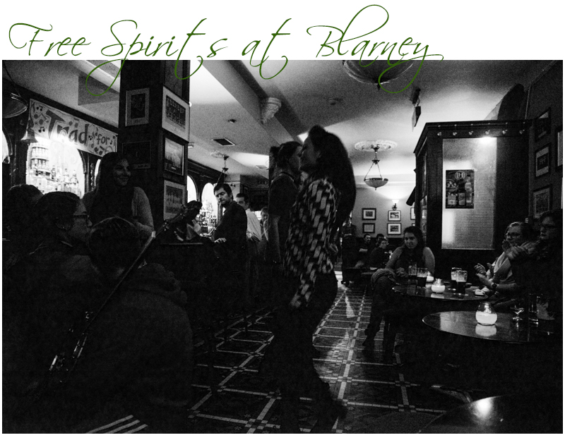
Three girls jumped up about twenty minutes into the evening after I arrived in the bar and did an impromptu Irish dance, tapping and stomping their feet and hard heeled shoes on the tiled floor, in rhythmic time with the music. It was a lot of fun, and very well received, and the audience, others like me sitting in the bar, were totally absorbed and completely entertained, and all clapped furiously with appreciation at the end.
Day Thirty Five – 19th. October – Wednesday – Late start this morning, as we meet at 10:00 am on the bus for a drive from Blarney to Kinsale. I didn’t get to Blarney Castle this morning in the hour allocated, instead I use the free time to do Internet banking and make a lengthy phonecall. Sandra however had an hour at the castle whilst I did this. She said it was not nearly enough time there, but managed to take some pics and throw a kiss towards the Blarney Stone. She said the steps up to the stone were precarious and murderous.
When we arrive in Kinsale, we drive first to a lookout that gives a great overview of the ancient town’s fortress at the entrance to the area’s natural harbour, and the town itself, sits off to the right of the lookout, in a sheltered inlet. A great spot for photos, and helpful later, when Barry our guide, who is waiting for us on arrival, explains the tax strategy of the governing body, early defences, the reclamation of land and the proximity of the original city wall surrounding the town, in earlier times.
The tour is really interesting in layout and Barry covers a range of historical and political subjects including the founding of a church called St. Eltin, here in the 6th. Century, the 1223 first Baron of Kinsale “DeCourcy”, the 1334 first town charter by Edward the 111 and in 1381 the town wall’s completion to enclose medieval Kinsale. Also touched upon was the 1588 battle of the Spanish Armada defeated by the English in the English Channel, and the 1601 Battle of Kinsale when the last Spanish Armada landed at Kinsale when O’Neill and O’Donnell marched to join them from Ulster.
Barry tells in 1689-1690 James 11 landed here after defeat in the Battle of the Boyne and that in 1703 William Dampier with Alexander Selkirk set sail on the famous journey that sparked the writing of the epic “Robinson Crusoe”. After that, but also important, was the birth in 1761 of Patrick Catter “The Kinsale Giant” who grew to 8′ 3″. Most famous of all though Barry strongly emphasises, was the 1915 torpedo German U Boat sinking of the English ship RMS Lusitania off The Old White Head of Kinsale with a tragic loss of life, killing 1,198 and leaving 761 survivors. The inquiry into the World War 1 disaster, he adds when he standing next to a grand and very old building, was held in the Kinsale Court House and the incident is believed to have been the single most important catalyst to bring America into the war. That building there he points.
I leave Barry and the group after an hour as he nears the end of his recitation. We are here in Kinsale for a while, and I am enormously distracted by the cute period buildings and interesting shop fronts so the camera is kept busy for a time, then I specifically seek out the Kinsale Crystal Shop.
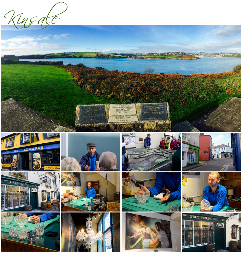
I meet up with Sandra here and we are given an impromptu demonstration on crystal making and cutting. We talk with the owner about Dingle Crystal and learn that two older family members, the man we are speaking with’s father and his father’s brother (his uncle) used to work at Waterford Crystal but broke away from the firm some years back. Waterford Crystal has since closed down so the two splinter shops are now thriving. Dingle Crystal and Kinsale Crystal, are owned by the two brothers and both have sons working in each business. The crystal is beautiful and very sparkly in the sunny day’s light, with items spread liberally around the room on the display counters. Expensive and beautifully heavy though, and I sadly realise, an absolute headache to purchase and take home in a suitcase to Australia, so I refrain. Sandra however, doesn’t.
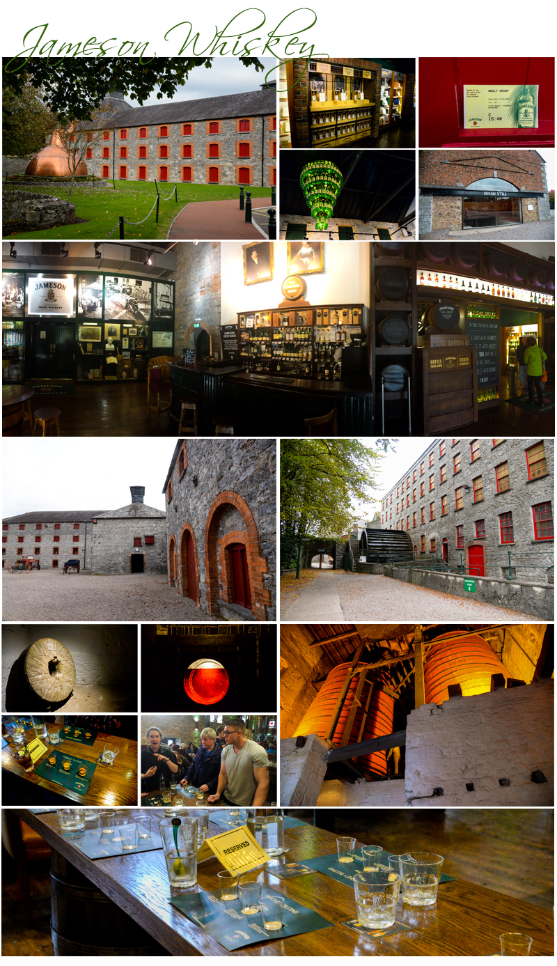
After lunch the bus heads to Cork, then to Midleton which is a little further on. We are advised there’ll be a whiskey tasting after the tour of John Jameson and Sons Whiskey Distillery this afternoon, and that there are limited spaces for this so be enthusiastic if you want to be selected for the privilege by putting your hands up. We arrive and spend thirty minutes waiting for the next tour to start. This time spent waiting, we all realise, could have been spent as extra time at Blarney Castle this morning so everyone is a little disappointed.
The tour takes us through the building at Midleton which is now no longer used for distilling whiskey, so it’s a history lesson in the facility that used to distill whiskey there. There are no real props or displays beyond some original equipment and large period photographs as simply the facilities have been left vacant, but left in pristine condition. The new distillery is to the rear of the property but we don’t go there. It is still, however, a very interesting and an enjoyable tour. It finishes in a micro brewery then a storage warehouse full of aromatic full oak casks of maturing whiskey. And of course when the time comes to show enthusiasm, I’m right up with the ones who are most enthusiastic of all. I get picked, and also equally as enthusiastic, so does Sandra.
We head back into the Shop and Bar area of the Distillery and are all given a free whiskey. Then our group of eight tasters are taken to a table set up for tasting. We have three shots each of whiskey awaiting our approval, a nip of Scottish Whiskey, a nip of Jameson Whiskey and a nip of American Whiskey.
It all goes down very well after a sniff, a sip, then skull. And three nips and a full serve of whiskey later, it pools deep in our bellies and the tendrils of warmth and well being seep nicely through each of us right out to our fingertips.
This is good stuff, I think of the Jameson brew. Mellow, lightly fruity. Very easy to swallow. The Scottish Whiskey, has a decidedly smokey flavour, whilst the American is not as smooth. But I’m not buying today, just enjoying the opportunity to indulge and chalk up to the experience of being in Ireland, and sampling a true Irish tradition, three times Irish Distilled Whiskey matured in charred Oak Barrels for no less than three years.
Blarney comes into sight at 6:00 pm after a busy day out and now it’s find a pub for a meal before retiring to bed. But we make a night of it, some of the group and I, at O’Connor’s Hotel first for drinks, meals and then coffees and finally back at the Blarney Hotel, for some music and dancing til late in the evening. This time the music is old school, normal folk music, and what I was raised on, local country dance music, singalong tunes and dance around in a circle rhythms. Gone are the fiddles and Irish musical instruments. It’s an organ. For a moment I am in a country hall, with all the townsfolk of Berriwillock, back in Australia, about twenty minutes drive from the farm where I grew up. It’s odd, familiar, and entirely Australian, or so I think. And I thought I was in Ireland?
Day Thirty Six – 20th. October – Thursday – We depart Blarney and head to Cork then, first the first time in ten days, drive on a freeway. We are heading to The Rock of Cashel in County Tipperary several hours away. The views from the motorway are quite good this morning, we are higher in elevation over the landscape and the views from the road, which don’t have barriers most of the time today, are lovely.
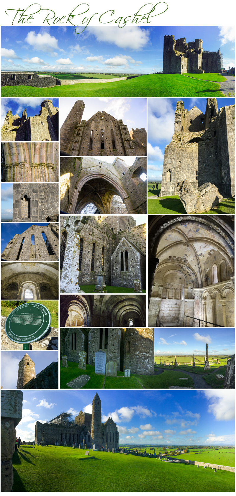
The Rock of Cashel was the traditional seat of the kings of Munster for several hundred years prior to the Norman invasion. In 1101, the King of Munster, Muirchertach Ua Briain, donated his fortress on the Rock to the Church. The picturesque complex has a character of its own and is one of the most remarkable collections of Celtic art and medieval architecture to be found anywhere in Europe. Few remnants of the early structures survive; the majority of buildings on the current site date from the 12th and 13th centuries.
The oldest and tallest of the buildings at The Rock of Cashel is the round tower which is 28 metres high and dates from c.1100 AD. The tower was built using the dry stone method and it is remarkable well preserved. Modern conservationists however have filled in some of the tower with mortar for safety reasons. Cormac’s Chapel, the chapel of King Cormac Mac Carthaigh was begun in 1127 and consecrated in 1134. It is a very sophisticated Romanesque structure. It has twin towers on either side of the nave and chancel and appear to have a German influence. Churches, which are ordinarily simple in plan with isolated decorated features. Other notable features of the building include interior and exterior arcading, a barrel-vaulted ceiling, a carved tympanum over both doorways, and a magnificent north doorway and chancel arch. It houses some of the best preserved Irish frescoes of the period.
The Chapel, constructed primarily of sandstone which has become water logged over the centuries, significantly damaging the interior frescos so restoration and preservation over the last few years using an enclosed rain-proof structure and dehumifiers to dry out the stone has been undertaken in recent years and the scaffolding and protective elements on the outside are to be removed in only a few weeks. The Cathedral, built between 1235 and 1270, has no aisle and is a building of a cruciform plan. The Hall Vicars Choral was built in the 15th century.
In 1647, during the Irish Confederate Wars the Rock of Cashel was sacked by English Parliamentarian troops under Murrough O’Brien the 1st. Earl of Inchiquin. The Irish Confederate troops there were massacred, as were the Roman Catholic clergy. Inchiquin’s troops looted and destroyed many important religious artefacts.
The Rock of Cashel sits on an elevated area of ground that overlooks the surrounding area in every direction and the sweeping vistas as seen from its perch, on this gorgeous, warm and sunny autumn morning are glorious. Panoramas are the images of the moment here. There are cows in the distance on my right, their soulful moos heard clearly from my elevated position. Irish houses are dotted amongst the patchwork of fields and hedgerows in all directions, and the romantic tumbledown relic of a large but early stone church is far away on my left. I can see for at least five miles on this clear weather day, so I can understand why the Kings of Munster chose this strategic defensive spot to build their citadel.
We depart The Rock of Cashel at 12:15 pm and drive on back roads again through to Kilkenny. We start noticing square tower houses, here and there, some fifty feet square but four or five stories high. There are reportedly seven thousand of these common structures in Ireland. They were built as a defensive structure or house for families to live in. In days past, pilfering and stealing, intrusion and takeover were commonplace, so these buildings offered some real defence in terms of guarding life, goods and chattels.
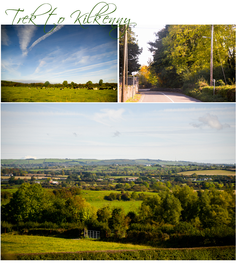
We pass some bog areas, then windmill farms as we near Kilkenny and of course farms. The city of Kilkenny, granted city status in 1609, is really the size of a large town in terms of Irish urban centres and is situated in County Kilkenny. Kilkenny is a popular tourist destination and when we arrive there’s flags gaily stretched high across the streets and people are everywhere.
Top of the list to visit here is Kilkenny Castle, St. Canice’s Cathedral, RotheHouse, Kilkenny Town Hall and St. Mary’s Cathedral to name only a few. Kilkenny is well known for its craft and design workshops, theatre, public gardens and museums.
The first stone castle at Kilkenny was built between 1204 and 1213 by William Marshall and was a symbol of Norman occupation and in its original thirteenth-century structure would have played an important defensive role for the town. Four large circular corner towers and a huge ditch, evidence of which, can still be seen today on the Kilkenny Parade. Originally a square-shaped castle with towers at each corner, only three of the four towers exist today.
Kilkenny sits aside the River Nore and after checkin at the hotel the rest of the afternoon is free time. I immediately make my way to the castle and walk around the stately building. It has exquisite gardens, public gardens, and access to them are through the castle’s main entrance or side entrances. There’s a formal garden in front with a fountain water feature, along the left side there’s walkways and steps leading down to a river access and another walkway along the river. I walk through the gardens for a time and the trees, old and well established are beautiful, the colours of autumn breaking through the lush verdant greens with pops of vermillion, ruby, mandarine and yellow.
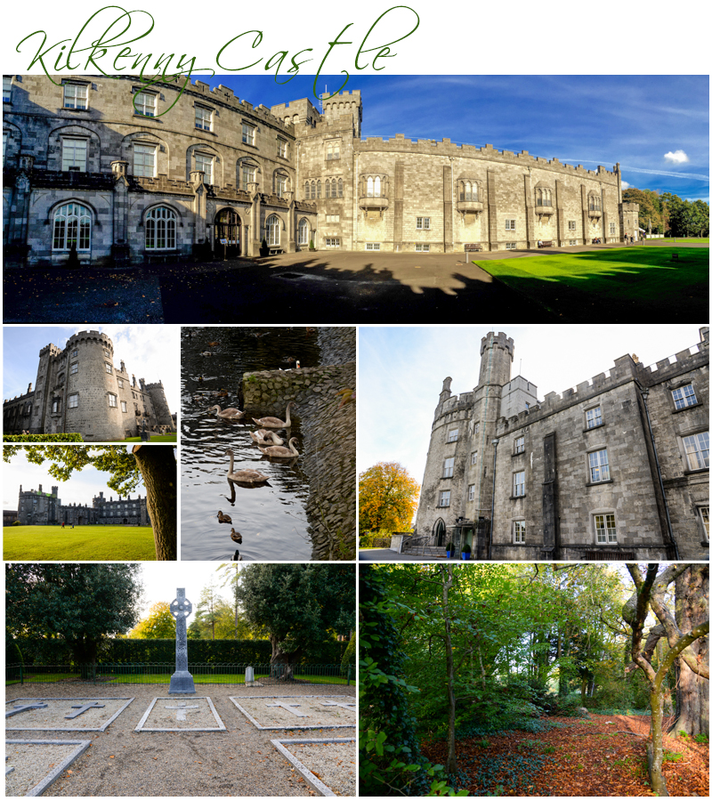 As I’m walking there’s joggers, other people walking, women strolling together pushing prams, mothers and fathers playing with their children, and people with their dogs scattered along the defined bitumen walkways and leaf litter paths. This is a popular park. I sit for awhile and simply enjoy the solitude. There’s a playground ahead and a hedged area to the far middle left. After a time I can see squirrels bounding along the exquisitely manicured verdant green lawns. Some children spot them and make chase then become distracted when the squirrels scale a nearby tree so they start collecting small boughs of wood that have fallen to the ground. It’s peaceful here. And the grounds are a wonderful compliment to the castle’s commanding vista.
The town of Kilkenny is busy today. After leaving the castle I head into town, a short distance from both the castle and hotel, and find some lunch, a little late in the day at 3:30 pm. The usual selection of tourist shops are here and I stroll around window shopping and taking only a few pics. I end up back at the river a short time later and see about two hundred teal ducks and five adult swans milling about just near the stone bridge that spans its width. I’ve finally managed a decent swan pic, but not in England as I’d thought, in Ireland instead.
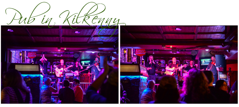
After dinner tonight, our last supper together, and thank you presentation of a card and gratuities money to Mick our fearless leader, a group of us head to the pub across the road for some local Irish music in the bar. Ciders, pints of beer and some whiskey all round for our group of seven, then we settle in for some fun with five musicians singing and playing Irish folk songs for the next three hours. It is a great evening, and Marlene one of our group keeps jumping up periodically to do some Irish/New Zealand step dancing. It’s very entertaining and hilariously funny as she’s just making it up as she goes along. She reminds me of a jack-in-the-box hopping up and down, arms stiff by her sides. Marlene is about mid sixties, tiny, and the life of the party. It’s a fabulous but late evening when we head back to the hotel.
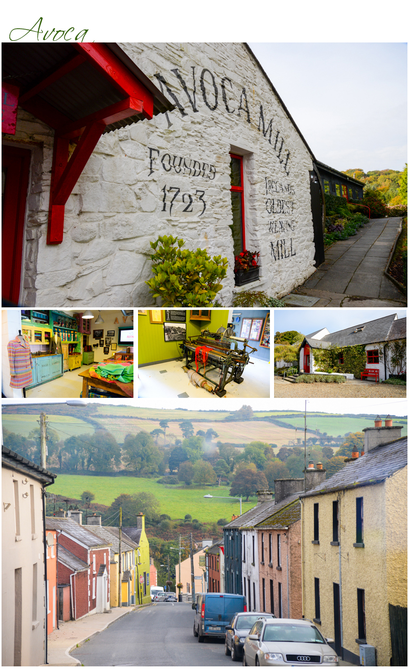
 Day Thirty Seven – 21st. October – Friday – Our final day in Ireland. We head this morning from Kilkenny towards County Wicklow and our first brief stop, the Avoca Woollen Mill. It’s a tiny village but there’s a museum just across from the gift shop at the Mill which sits on the edge of a very small running stream. Just enough time here for a coffee and a restroom break then we are off again, this time towards Glendalough.
Glendalough is a Romanesque style Monastery built around the 6th. Century which was disestablished in 1398. The founder Saint Kevin was a descendant of one of the ruling families in Leinster and studied as a boy under the care of three holy men Eoghan, Lochan and Eannan. Kevin went to Glendalough during this time but returned later as an adult with a small group of monks to found a monastery (at Glendalough) where the “two rivers form a confluence”. His fame as a holy man spread and he attracted numerous followers. Kevin died in around 618 AD and for about six centuries afterwards Glendalough flourished.
The ruin of Glendalough today are in a state of decay, and are set amongst the gravestones of a large graveyard. The lichen covered headstones are mostly blind embossed with dates on them that cover a range of centuries up to recent times and some of the older ones are very hard to read, the weather and elements over time having softened the edges of the words and worn down the surfaces of the sandstone blocks. I see on one headstone words upside down on it to the rear. Recycling, or maybe saving some costs reusing a headstone at some early point in time I would think as it’s very old.
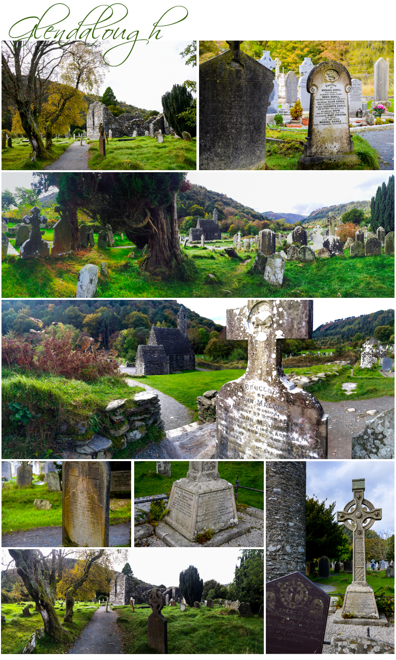
There are hiking trails here, and some very lush cold climate forests. They are thick, tall, verdant, cool and green, with the colours of autumn blushing their way through the overhead canopy with the promise of winter on its way.
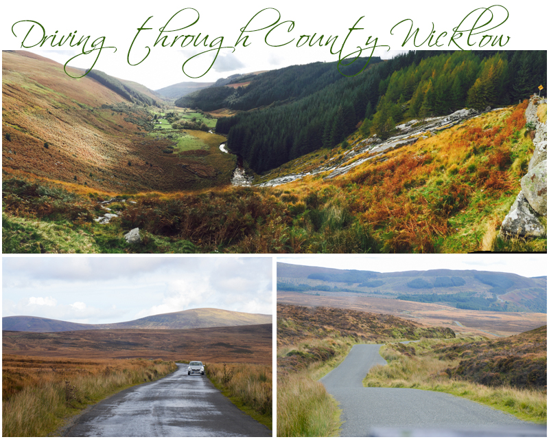
We drive towards the Sally Gap which was once called The Old Military Road and the landscape once we gain elevation almost instantly changes. We pass a huge and very high rock formation with a lovely waterfall thundering down its height. Then we enter the blanket peat bogs in the Wicklow Mountains in County Wicklow. The landscape is beautiful, vast, desolate yet spectacular with a single lane road with only the occasional passing bay, winding its way across the rises and falls like a flat ribbon casually strewn atop the brown foliage of the spongy heather encrusted surface. There’s only a few cars trekking through the area today, and several mountain bike enthusiasts. It’s a beautiful area for bike riding. Motor bikes as well. Our last day in Ireland is again, clear and sunny with the bluest of skies.
The road takes us to a particularly high area lookout which peruses the Guinness family’s private lake, Lough Tay, and its surrounding hinterland. This is the site of the fabulous series “Vikings” film set. The scenery is familiar to me, as I’m a fan of the series, and I’m thrilled to be seeing the beautiful setting that has managed to ply its charms on the series’ producers. I half expect to see Ragnar and Lagertha, Rollo and Floki.
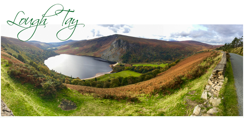
We see a huge parking bay high above the lake where we are told the dozens of trucks and film set props are brought to each time the crew films, but today it is deserted, entirely empty. There are signs saying keep away, private property and there’s a security guard standing at the entrance gate high above the road that leads down to the lake. The lake is situated quite close to Dublin if you come in from the other direction. So for the producers, crews and actors it’s only a short drive from major airports and easily accessible.
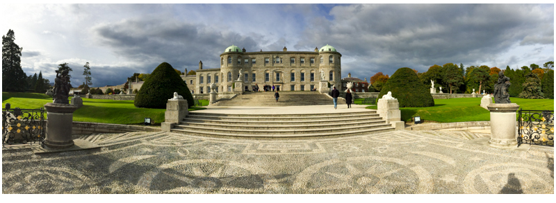
We drive on further towards Dublin but stop for a late lunch at the beautiful country estate Powerscourt which showcases comprehensive gardens. The house, built in the Georgian style is very grand and stands three stories high, but we are here to visit the gardens that took some one hundred men, more than twelve years to establish and twenty years to develop. The garden vision began in 1857, was briefly halted at one point, but was finished by 1880.
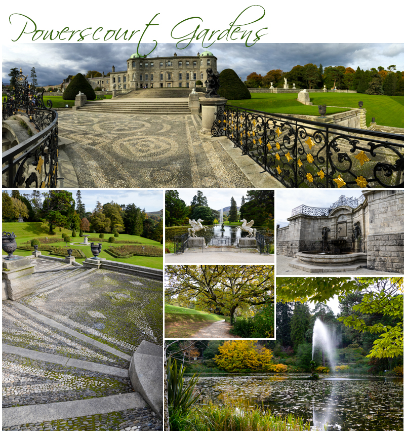
The Powerscourt Gardens have sweeping views from the elevated position at ground level at the top of stone stairs which start at the back of the house. There is a reasonably high retaining wall at the highest level here and it is dotted with statues and urns. The retaining wall falls away to sweeping lush green lawns, and these then drop away down several levels in an angular step pattern with a large paved walkway in the centre, and stone steps which follow the gardens various levels down to the platform lookout area where there is a man made lake. The platform lookout is fenced with black metal uprights interwoven with delicate gold leaf patterns.
This small lake at the bottom of the dramatic staircase has a water feature in the centre blasting a water spout high into the air. Near the elevated platform there are two wide side stairwell’s with a gentle gradient curve off to each side. The pretty pebble placement here creates patterns on the side gradients, and these are edged on their inner borders with the same black metal fencing as near the platform below.
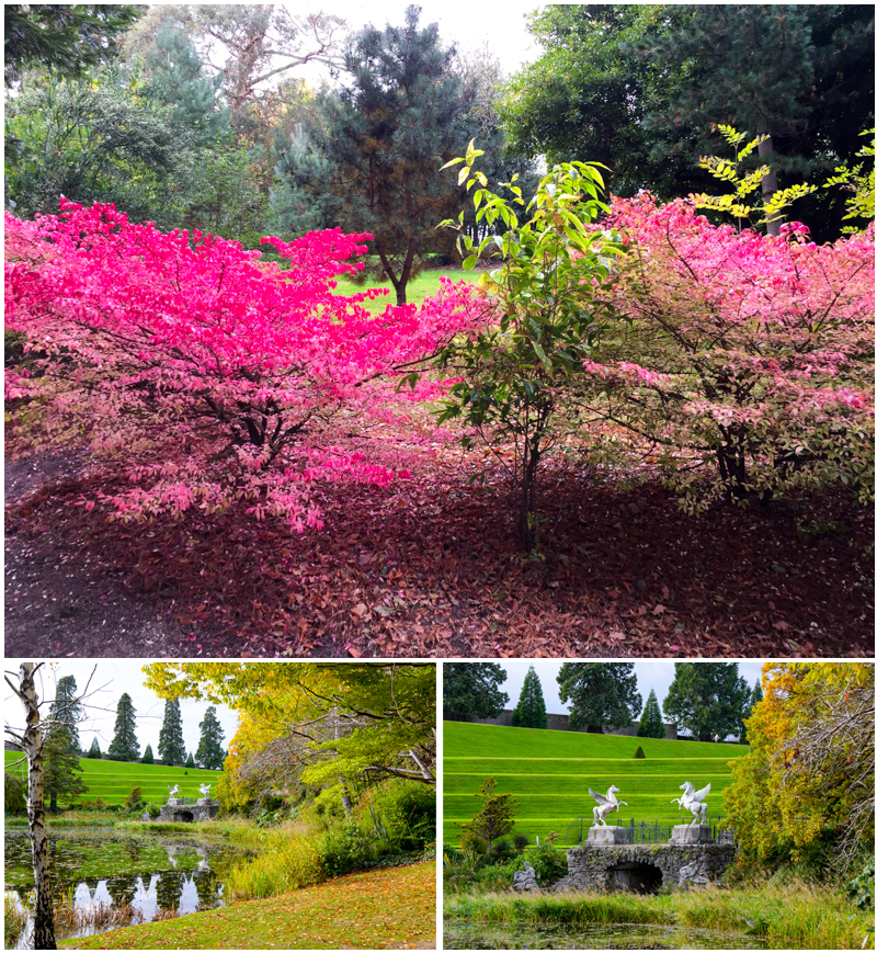
To the left side of the lake as you make your way around the reed and water lily encrusted waterbody, is a small Japanese Garden created in a large bowl shaped depression to the left. It is flanked above with a large variety of beautiful mature, of differing species. The Japanese Garden is full of autumn colour today as many of the plants including some exquisite Japanese Maples are in full autumn bloom, bright lipstick Reds, tangerine oranges and sunny gold yellows. There are a few traditional Japanese elements in the garden like statues and a small Japanese wooden house with a walkway bridge over a stream and a tiny pond.
To the right on the other side of the larger lake directly in front of the rear of Powerscourt is a raised area where there is a garden filled with established trees, azaleas and rhododendrons, and a small pet cemetery on a side slope. It is a wide variety of animals that are buried here doge, cats, some horses, a donkey and even some cows. I feel for “Eugenie” the Jersey Cow who died in 1967 aged 17 years. She had 17 calves and produced 100,000 gallons of milk and “Princess” the Aberdeen Angus Cow who died in 1972 aged 11 years, a two times Dublin Champion. It’s corny but kind of sweet.
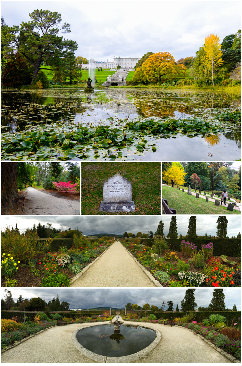
From the pet cemetery there’s a pretty walk around another pond which then takes you to a formal high walled garden. There are masses of flowers planted in the strip beds here and they are cheery, fragrant and very, very colourful. The path in the walled garden leads on through the middle to a fountain area and just beyond there’s high gates leading to a nursery and preparation area with two large green houses and some formal rose gardens amidst more significant lawns and statues on stands.
Powerscourt is a relaxing really peaceful place, which offers a wonderful retreat from the world outside in its beautiful serene and very tranquil surrounds. It was a pleasure to visit here today, and it reminds me of my visit to the gardens at Versailles Palace in Paris, France.
We leave at 4:00 pm for the final hour and a half trek into Dublin through peak hour traffic. It’s a slow affair today, stop start, and when we get close to our destination, the Cassidy Hotel, there’s major roadworks as the city is revamping their public transport system and have ripped up several of the roads condoning off sections, which is effectively squeezing the mass of Dublin’s inner city traffic into endless tight bottlenecks moving only at snails pace.
We arrive back safely at 5:20 pm and the tour disbands. Mick our driver has brought us all back to where we started our journey some thirteen days ago. The time has flown, we have been blessed with amazing weather, seen some fabulous countryside and visited some of Ireland’s most fabulous icons. A major history lesson in less than a fortnight and it has been wonderful.
Tomorrow I head for New York and the start of my USA trek across the country. Very excited to be meeting Mary B, my pen pal of twenty five years for the very first time, and very much looking forward to spending the next ten days with her as we trek across New York State to Honeyoe Falls, to see her home, her family and some of her favourite places.
 As I’m walking there’s joggers, other people walking, women strolling together pushing prams, mothers and fathers playing with their children, and people with their dogs scattered along the defined bitumen walkways and leaf litter paths. This is a popular park. I sit for awhile and simply enjoy the solitude. There’s a playground ahead and a hedged area to the far middle left. After a time I can see squirrels bounding along the exquisitely manicured verdant green lawns. Some children spot them and make chase then become distracted when the squirrels scale a nearby tree so they start collecting small boughs of wood that have fallen to the ground. It’s peaceful here. And the grounds are a wonderful compliment to the castle’s commanding vista.
 Day Thirty Seven – 21st. October – Friday – Our final day in Ireland. We head this morning from Kilkenny towards County Wicklow and our first brief stop, the Avoca Woollen Mill. It’s a tiny village but there’s a museum just across from the gift shop at the Mill which sits on the edge of a very small running stream. Just enough time here for a coffee and a restroom break then we are off again, this time towards Glendalough.


